Santa Teresa: Costa Rica's Pacific edge of the Nicoya Peninsula - Test Only
Santa Teresa sits on the western coast of Costa Rica's Nicoya Peninsula, where a single dirt-road main street runs north-south parallel to a series of beaches that face the Pacific. The town smells like dust and salt and frangipani, and at dawn the howler monkeys in the canopy out-volume the surf. It became a surf town in the 1990s and has since added fiber internet, a few real grocery stores, and a steady inflow of property buyers from North America, Europe, and Argentina — alongside a real estate market that operates under two distinct title structures depending on how close to the water a property sits.
The setting
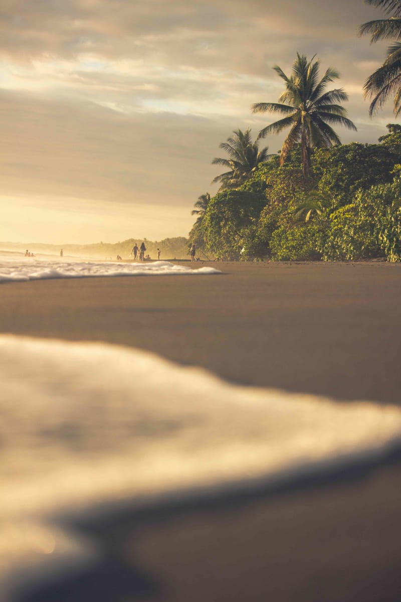
The Nicoya Peninsula juts into the Pacific on a north-south axis. Santa Teresa runs roughly four kilometers along the coast, with the contiguous towns of Mal País to the south and Playa Hermosa to the north. The climate is tropical with a clean dry/wet split: December through April is dry, hot, and dusty, with offshore trade winds; May through November is rainy, greener, and with cleaner south swells.
Power is on a grid but flickers in storm season; many newer builds carry solar plus battery backup. Fiber internet runs the full length of the main road and reliably hits 100+ Mbps in town; gigabit is available at the higher-end builds. There is no hospital in town — the nearest is Cobano, 8 km inland, with the larger hospitals in Puntarenas across the Gulf of Nicoya. The Tambor airstrip handles the daily SANSA flights from San José and is a 45-minute drive south; the Paquera–Puntarenas car ferry is a 5-hour drive option for anyone bringing vehicles or quantities of cargo.
The breaks
The town's main break is Playa Carmen, a beach break that picks up just about any swell with consistent shoulder-to-overhead waves and a sand bottom that shifts seasonally. South of Playa Carmen, the rocky point at Mar Azul holds bigger, longer rights on south swells and is the local advanced-intermediate option. Further south at the end of the road, Mal País has a left point and a sandy stretch that handles size and works on most tide phases.
North of Santa Teresa, Playa Hermosa offers a long sandy stretch with less crowded peaks; further north still, the headland at Manzanillo holds a right point that works on bigger swells. The surf is consistent year-round; the cleanest conditions track the May–November south-swell season, which overlaps the rainy season. Trade winds are offshore for most of the dry season but can blow sideshore in the afternoon. Tide swings exceed two meters, so the standard local practice is to check the tide chart before planning a session.
The real estate shape
Two title structures matter for a foreign buyer in Santa Teresa. The first 50 meters from the high-tide line is a Public Zone — no construction, no titles. The next 150 meters out is the Maritime-Terrestrial Zone, where ownership operates as a Concession-Maritime: a renewable concession granted by the local municipality, typically for 20-year terms, treated for foreign-buyer purposes as a leasehold (Costa Rica's Maritime-Terrestrial Zone Law 6043 governs the structure; one of the five title types covered on SurfPostings). Beyond the 200-meter Maritime line, property can be held as Fee Simple — full freehold, with no foreign-ownership restriction beyond standard registration.
Most properties listed at the beach in Santa Teresa carry Concession-Maritime title; most properties up the hill or in the hinterland are Fee Simple. Rough USD bands as of late 2026: condos and small hinterland houses start around $250K–$450K; established hillside homes with ocean views run $600K–$1.2M; beachfront concessions vary widely but typically start around $800K and run past $3M for the rarer fully built-out estates. A local notario público is required on any title transfer; engaging Costa Rica-licensed counsel before any deposit is the standard practice. Consult a local attorney before any transaction.